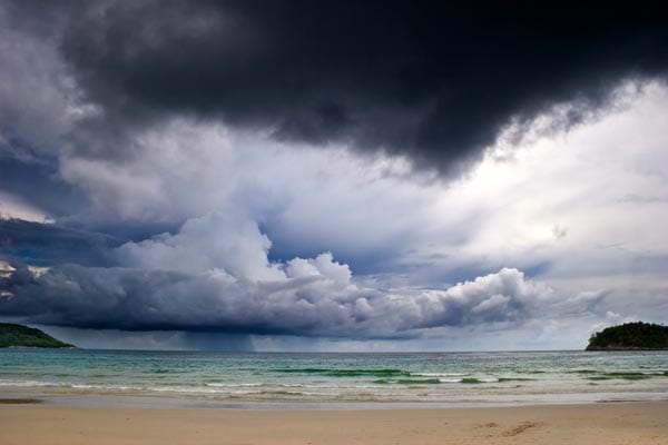
After a whole year of confusing atmospheric and barometric ups and downs, we are finally well on our way into the start of the warm summer. While we often spend all year round looking forward to summer vacations, the cold moving out, and all those days soaking up the sun on the beach, did you know that summer also marks the start of hurricane season? While it’s important to take the time to enjoy the warmer weather, it is also important to be aware of and prepared for hurricane season.
The 2016 Atlantic hurricane season began only this month, on June 1st, and will end on November 30, 2016. This is an event in the annual tropical cyclone season in the northern hemisphere. These dates are used to describe the period of time during which the vast majority of tropical cyclones form in the Atlantic Basin and are then adopted by convention. Convection creates a band of air at a certain radial distance and begins to rotate fiercely. This becomes the area of strongest winds that initiates a feedback loop through which storms continue to gain power.
A hurricane is classically described as a storm bearing violent winds. These large tropical storm systems generally have high powered circular winds that revolve around an eye (an area of generally calm weather 20 to 40 miles across) at the center of a hurricane, with a wind force that equals or exceeds 74 miles per hour. These storms are often accompanied by heavy rain, thunder and lightning.
It is important to remember that while hurricanes commonly occur during this season, it is not unheard of for them to occur outside of this seasonal window. Hurricane Alex and Tropical Storm Bonnie are just two memorable examples of tropical storms which did not adhere to seasonal constraints. This particular season started incredibly early, with hurricane Alex taking shape in the Northeastern Atlantic in mid-January. Tropical storm Bonnie occurred in late may, making 2016 an odd year for storms. This has been the first year since 2012 in which two preseason storms occurred, and only the third occurrence of this pattern of weather in a year since 1951.
Most forecasting groups have described this season as a near average to above average season. This is due to a number of factors, but includes the usual transition to La Niña as well as a disparity in global surface temperatures in the sea. While there are warmer than normal sea surface temperatures in the Caribbean, Gulf of Mexico, and Western Atlantic, sea surface temperatures are near average in the Atlantic Main Development Region in the area of Cape Verde.
It is important to be ready for hurricane season, and know how the excess water, wind, and potentially inclement weather can affect your lawn and grounds. For more information on keeping your property beautiful, contact JFC Grounds Maintenance LLC today.